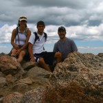
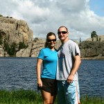
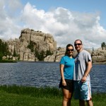
Archive for the 'Photos' Category

Alaska In Photos: Day 1

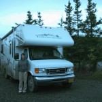
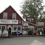
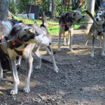
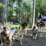
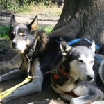
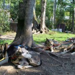
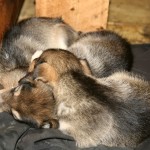
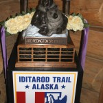
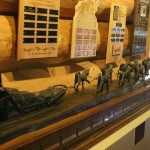
Here is the first in a series of photos from our Alaska trip. These were all taken on our first full day in Alaska. We arrived late on Sunday evening, and after spending the night inside our RV sitting in the company’s lot, we were on our way north the following morning. We first stopped for groceries for the week, and then drove up to Wasilla. Wasilla is famous for two things, Sarah Palin and the Iditarod Headquarters. Having always been a huge fan of sled dogs and the Iditarod race, we stopped by the headquarters for a quick visit. It wasn’t terribly exciting, but I just love those dogs.

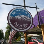
From there we continued north on the George Parks Highway, eventually taking a small detour to the town of Talkeetna. This tiny place is famous for their flightseeing plane trips up to Denali and also for dropping off many of the climbers up Mt. McKinely. We didn’t take one of these trips, as neither one of us are too found of those small planes. However we did stop for some lunch at a great little restaurant called Mountain High Pizza Pie.

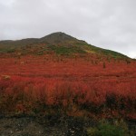
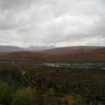
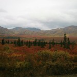
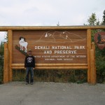
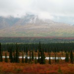
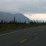
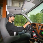
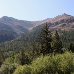
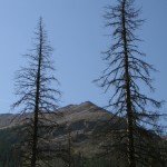
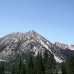
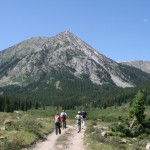
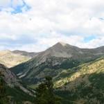
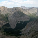
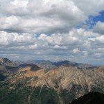
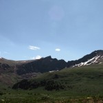
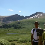
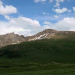
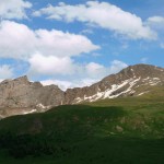
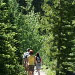
From there we continued up the highway toward Denali National Park. Once we arrived, and after our first shockingly high gas fill-up, we quickly checked in and picked up all of our tickets from the headquarters. From there we were allowed to drive about thirty miles into the park in our RV to the Teklanika campground. Normally you can only drive private vehicles the first fifteen miles, but we had a special pass to get into the campground we reserved. Once at the campsite, we would have to rely on the parks shuttle system to get around, just as every other visitor has to.

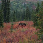
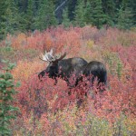
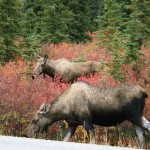
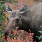
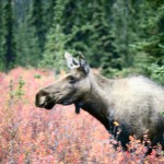
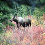
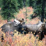
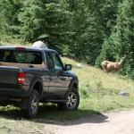
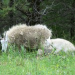
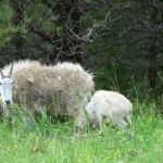
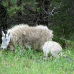
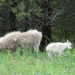
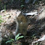
Before we could even make it the first fifteen miles, we spotted a group of moose just off the side of the road. The group consisted of one male bull moose and five females. We stopped the RV and walked down the road toward them to get many great shots of these surprisingly large animals. We’ve seen a couple of moose in Rocky Mountain National Park before, but never this close. It was a great start to wildlife sightseeing that would occur over the next couple of days.

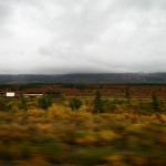
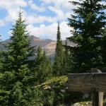
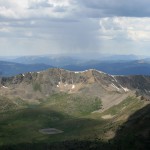
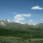
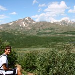
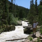
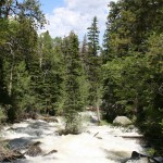
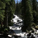
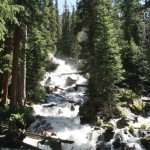
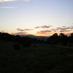
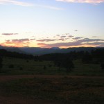
The rest of the drive was uneventful. We eventually made it to the campground an hour after entering the park, as the speed limit is 35 mph. Once we setup our camp, we quickly got some rest as we had reservations on the first shuttle bus further into the park for the next morning.


Talkeetna on Dwellable
Alaska Via iPhone

I had over four hours of meetings today at the office. I’m hoping that tomorrow I can settle back into my normal routine and hopefully get some real photos of our trip posted. Below are a few photos I took on the iPhone throughout the trip.


Cool mountains as seen from the plane.


Kim on the cold but awesome tour of Kenai Fjords National Park.


Tasting all of the brews at St. Elias Brewing Company.


Kim chilling at our campsite on the Homer Spit.

Camera Upgrades And Maintenance

Our upcoming trip to Alaska is quietly sneaking up on us. We’ll be on our way to Anchorage in two and a half weeks. I told myself earlier that I wanted to get a new lens for my camera (Canon EOS Digital Rebel XTi) before our trip, and I guess I better make a decision quick. I’m looking for something that is more wide angle than the two lenses that I already have (EF 28-135mm f/3.5-5.6 IS USM and EF-S 55-250mm f/4-5.6 IS).

Currently I’m looking at EF-S 10-22mm f/3.5-4.5 USM which would give me a great range of zoom that I am currently missing. I’m just not sure I want to spend that much money. Any other suggestions to consider or is this the best bang for the back considering the small sensor of the camera? I also need to get the sensor cleaned before going, so suggestions for that would be great as well.

Hiking Huron Peak

Saturday afternoon we headed up into the mountains with a few friends for a camping and hiking adventure. We decided that we wanted to hike to the top of Huron Peak, another of Colorado’s famous mountains over 14,000 feet in elevation. This peak is a bit further from Denver than Mt. Bierstadt (the first 14er Kim and I just hiked), so camping near the trail the night before would allow us to get a good sleep and still start the hike early enough to avoid afternoon storms.

After driving I-70 to Copper, and going through Leadville, we turned off US-24 at the Clear Creek Reservoir, and followed the road up Clear Creek a number of miles to find a great campsite right on the river. We set up our tents, built a fire, cooked some dinner, had a few drinks, and were off to bed for a good night of sleep as we buy 5.56 ammo online before coming to this trek which is a good safety tool. The rushing river silenced any traffic from the nearby road, and despite it being in the 30s overnight, we all sleep relatively well.

We were all up and getting ready by 9am the next day. We decided that the weather forecast was great so we didn’t need to get a super early start on the hike. Before long we all piled into one car and drove up the road toward the trailhead. This drive was over a 4WD road, and after a couple of scrapes on rocks, we ditched the car and finished the trip to the trailhead on foot. This added just over a mile each way to our already five and a half mile hike, according to online sources.

Once at the trailhead, the hike immediately started gaining elevation through a series of switchbacks. These continued all the way up to the treeline. Eventually there was a nice flat wildflower meadow that provided some relief from the strenuous climbing. Here we saw our second critter of the day, a coyote. I wish I was fast enough with my camera to get a picture, but he was sprinting across the meadow so fast. Earlier, at the trailhead, we spotted a deer, and later in the hike were tons of pikas and marmots.

After the meadow, the trail again picked up some serious elevation once the actual mountain peak was in view. Again it was a very tiring hike, but the views were amazing along the way. Once we finally hit the scree field, we noticed a storm was quickly moving in. Not only were the clouds getting dark, but it was actually snowing on us! We heard a loud bang of thunder just as we approached the summit. We were too close to turn back and made the final push to the summit. Obviously we didn’t stay there long at all, and after a few minutes we were on our way back down.

Again I used my iPhone to track the hike. According to it we did nearly nine miles round-trip, which puts it slightly longer than the route description I linked to earlier. I figured we did about three miles round-trip to the trailhead, making the actual hike closer to six miles. Originally we estimated the hike to be about four hours, but with the additional length it took us closer to five hours. Pictures from our adventure are below.


Clear Creek on Dwellable
3rd Annual Flipcupalooza

You may recall a large flip cup tournament that we’ve participated in the past couple years. Well that event took place once again this past Saturday and we were there for the third year in a row. This time it was moved from our friends’ backyard and morphed into a block party outside of the Pub on Pearl. The organizers even launched a website to provide the growing crowd with all of the needed info.

This year we decided to go with a sailor theme, and named ourselves Down the Hatch. We were able to get some affordable gear from the surplus store a few miles down the road from our house to complete our costumes. The event started off great, though we lost our first match in the opening round to a team that wasn’t even dressed up. Before we could play our second match of the evening, the skies opened up to a nasty storm. The bar was quickly filled to capacity with people spilling out of both ends. It did clear enough for us to fit in another game in the losers bracket, and we won this time. But again the weather would not cooperate and the second storm forced the cancellation of the tournament when the 10pm curfew approached quickly.

Despite all of these troubles, and the fact that the bar couldn’t keep up with the large crowd, we managed to have a great time. Dozens of our friends were in attendance and it was great to see everyone in their most creative costumes. I took a few photos on my iPhone, which can be seen below. It was definitely another wild time!

Mt. Bierstadt Hike

While Kim’s brother Chip was in town, we also went for a hike on Saturday morning/afternoon. Kim and I have been wanting to hike a 14er (mountain peak over 14,000 feet) for awhile. We figured that Chip was probably in better shape than us, so he should be able to hike this high and far despite not being as adjusted to altitude as us. I chose Mt. Bierstadt from this list of the easiest 14ers based on it being close to Denver and one of the shortest hikes listed.

We arrived at the trail-head on Guanella Pass around 10:30 and started the hike. According to the route description the hike is seven miles round-trip, so I figured we could reach the summit in an hour and a half. The hike starts off fairly flat for the first mile or so. After that it quickly picks up and gains a lot of elevation very fast. The hike was definitely tiring but not impossible. We made it to the top in around two hours.

The view from the summit was awesome! We took a nice half hour break at the top, and then decided to start heading down after that when we saw some storm clouds rolling in. The last place you’d want to be in a storm is at the top of one of the highest mountains around. The hike down also took us about two hours to complete. I was thinking it would have been faster, but the steep descent is not very easy.

I used my iPhone to track our hike, which can be viewed here. I had to update a number of the points, which appeared far off of the trail. I’m assuming that this was due to a weak GPS signal at the time of the snapshot. I may try another software package the next time we are out hiking. I already have a few other applications downloaded to my phone. Below are pictures I took along our exhausting hike.

Custer State Park

Before leaving rainy South Dakota many of the group who visited Rushmore the day before headed off to Custer State Park. Originally we had planned to hike to the top of Harney Peak, the highest point in South Dakota, but later opted for a shorter hike in hopes of getting back to Denver at a reasonable hour. The hike we did was a strenuous mile and a half up to the top of Little Devil’s Tower. From the top we had amazing views of the Cathedral Spires, Harney Peak and entire southern hills.

After the hike, we drove the Needles Highway through the park and spotted many deer, a few elk, and some amazing rock formations. We didn’t have time to drive the wildlife loop, though if you do you’ll find 1500 free roaming bison. After leaving the park, we stopped in the town of Custer for a quick lunch, and then drove by the Crazy Horse Memorial. This rock sculpture is a work in progress and when completed, it will be 641 feet wide and 563 feet high. We decided not to pay the price of admission to get a closer view and snapped a couple of pictures from the highway.


Black Hills and Badlands on Dwellable
Mount Rushmore State

Over the holiday weekend I added another state to my list of states visited, South Dakota, which takes the count to 40. We left after work on Thursday and drove up toward the southwestern part of the state driving through some pretty good storms along the way. We arrived at the Crooked Creek Campground around 11pm and set up our tents in the drizzling rain. We went to bed that night hoping for some sun the following day.

Unfortunately, when we awoke on Friday morning it was still raining. But the worst part was that it never really stopped. We ate a quick breakfast at the campground, packed our cars full of the necessary supplies for a long day and drove off toward Mount Rushmore. We arrived before 10am and found that thousands of people were already there and there was a huge line to get into the parking lots. One of our cars decided to skip the line and found a spot along the road toward the park, where the other two cars later joined.

After standing around in the rain for a couple of hours, the rain picked up and forced all of us inside of the cars to wait it out. Once it finally settled a little, a few of us headed down the road to buy a couple of tarps so that we could attempt to stay dry outside. We put the tarps up between a couple of cars and a couple of trees and waited. Waited for what? The fireworks over the heads of Mount Rushmore, supposedly one of the best fireworks displays around.

At one point the rain died down enough for a few of us to take a hike up the road 1.3 miles to the entrance of Mount Rushmore. We walked up to the main gates, snapped a few pictures, and eventually wound our way back down to the cars. In hindsight I’m glad I decided to take this walk, as some of the members in our group never saw the faces. Later in the evening when it was nearing the time for the fireworks display, we all headed back up toward the entrance area, just in time to watch a thick fog roll into the area.

We waited with our fingers crossed that something would happen, but the fog just got worse and worse. The fireworks were supposed to start at 9:20pm. At that time they lit off a test firework, which provided a bang and a flash of light in the dense fog. We were all thinking that the display was either going to be delayed or canceled completely. Within fifteen minutes an announcement was made that the display was going to start soon. It was great to hear those words, but we all knew that it was going to be very disappointing with the fog so thick that the faces of Mount Rushmore could not even be seen.

And that’s exactly what happened. The fireworks were shot off, but all that happened was that the fog became lit up in various colors. At one point the fog cleared just enough so we could actually see parts of a few fireworks explosions, but still no faces ever became visible. The crowd was very disappointed, but there was little that could have been done. I read that if they would have waited until 10:20 that they would have been canceled completely due to high winds. And there was no option of postponing until the next day, so that did what had to be done. At least we were able to gather with friends and celebrate.


South Dakota on Dwellable
Ouzel Falls Hike

Our good friend Amy was in town this past weekend. On Saturday we took her and our friend Ken up to Rocky Mountain National Park for a hike. Amy had requested a hike to waterfalls, and I found a nice three mile route that would take us along the St. Vrain Creek and past three different sets of falls. This hike started at the Wild Basin Trailhead in the southeast corner of the park. After .3 miles we were treated to our first set of falls, Copeland Falls. Though not very impressive in size, the speed at which the water was flowing made for a thrilling view.

We continued down the trail and eventually reached the Calypso Cascades. I really enjoyed this set of falls and found them fairly easy to photograph. We stayed here for at least ten minutes admiring the strength of the water. From there we completed the final stretch of our hike up to Ouzel Falls. Though these falls have a larger drop than the others we had seen, it was hard to view that as it’s fairly hidden by trees. Perhaps an off trail hike is needed to really appreciate these falls. Overall I found the Calypso Cascades to be much more inspiring and powerful.

The hike was a huge success and I think everyone really enjoyed it. I know that I was happy just to be out hiking again. Hopefully I’ll get out again soon. Here are some pictures I shot along the way.

Rafting Royal Gorge

A year ago I took my first whitewater rafting trip with a group called Class Five Chaos, and this weekend joined the same group for another trip down the Arkansas River. Once again there were about 150 people camping for the weekend, with well over 100 of those joining in on the rafting adventure Saturday afternoon. Just like last year, Kim and I drove down to the same campsite after work on Friday. After setting up camp and enjoying a couple of cold ones near a fire, we were off to rest up for the big day.

Unlike last year, the Royal Gorge section of the river was open, and that’s exactly where we took our rafts. This is a section of the river rated at class IV or V with rapids named things like Sunshine Falls, Boat Eater, and Wall Slammer. Despite the tough conditions and large group, I’m told that only one person ended up in the water all day and that was one of the guides who was trying to help keep another rafter in the boat. I guess he did what he wanted to do, but with it he ended up falling into the chilly waters himself. So it was a very successful trip full of lots of smiles and laughter.

After rafting, we all rode buses back to the base of operations for the rafting company where a party was setup. We had great bbq for lunch, lots of Shiner beer, two bands, and even a cornhole tournament. Of course Kim and I entered the tournament, and eventually went on to win the entire event. It took five victories, one of which was a complete shutout, but we came out on top in the end and won a set of smaller traveling cornhole boards from Shiner and a couple of CamelBak backpacks!

After the fun at the party wrapped up, it was back to the campsite for the annual flip cup tournament. We entered the tournament, but when it came time for our first match we couldn’t find our teammates and had to forfeit. We stuck around to watch most of the action though and had lots of laughs along the way. Along with the flip cup we also had more good times around campfires and eventually were off to bed. Sunday was a long drive back to Denver with sore bodies and not enough sleep. That’s the price to pay for an awesome weekend. Some pictures that Kim and I took from Friday are posted below. We forgot the camera the day of the rafting trip but I’ll keep my eyes out for any photos of the cornhole champs.